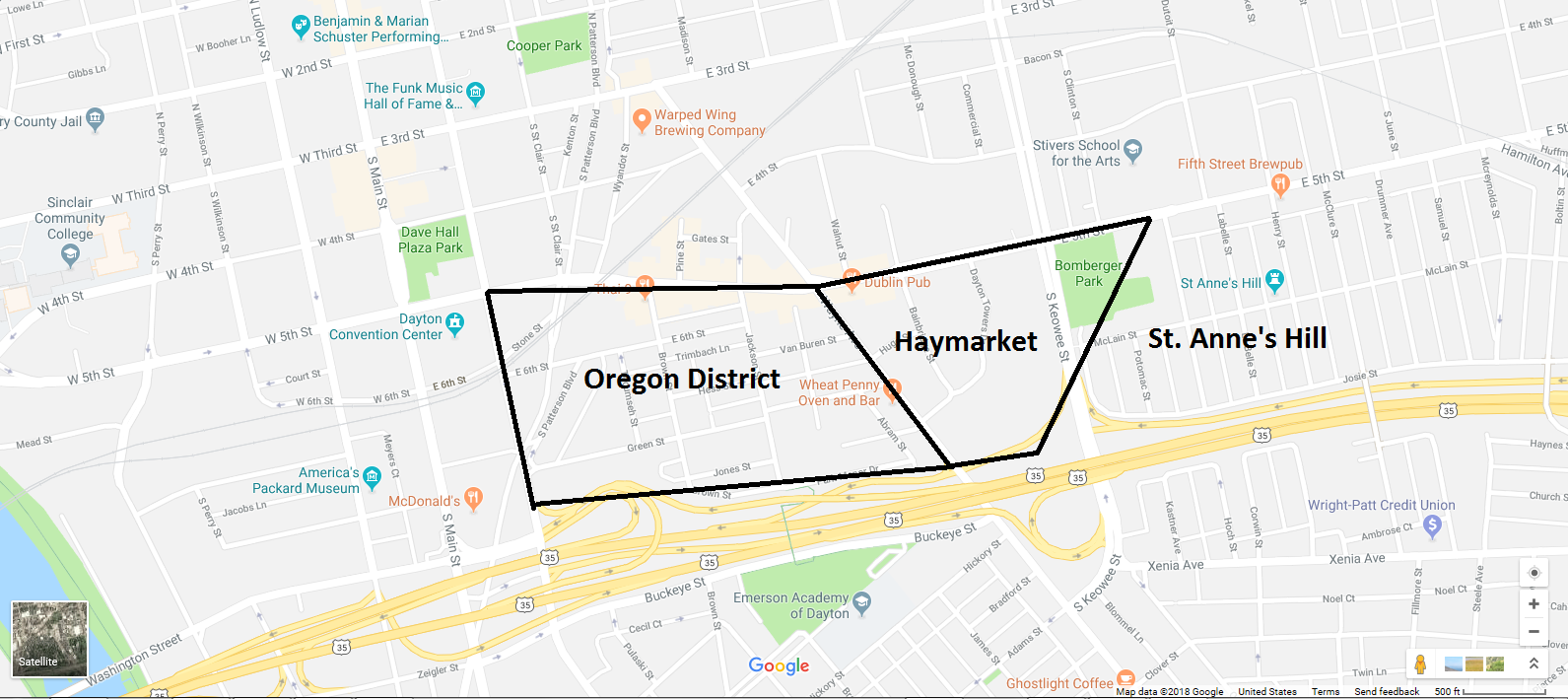
In many of my presentations (and my book Lost Dayton Ohio), I tell the story of the lost Haymarket neighborhood, which was located in between the Oregon District and St. Anne’s Hill, and how it met its end.
This article will also chronicle the end of the hay market, but this time I’m talking about the actual market that gave the area its name.
From the early years of Dayton’s existence this market was a crucial city function, and one which carried a larger role than we might assume in modern times.
The hay market was one of Dayton’s first municipal offices, and farmers from miles away brought their product here to have it officially weighed by an elected official known as “master of weights” or the “wood measurer.”
The market involved more than just weighing hay, as explained in a Dayton Daily News article:
“Horses were brought there and before any deal was negotiated involving the(ir) sale, the contestants in the old game of trade wanted to know what they were getting, so the master of weights was called upon to perform.”
At its height the market employed “an entire corps of workers” who assisted in these and other important functions.
In addition, the haymarket was even said to serve as a “community center” for the larger neighborhood.
The master of weights “was called upon to settle quarrels and disputes and to adjust the affairs of a part of the city’s citizenship.”
Where Exactly Was Dayton’s Hay Market?
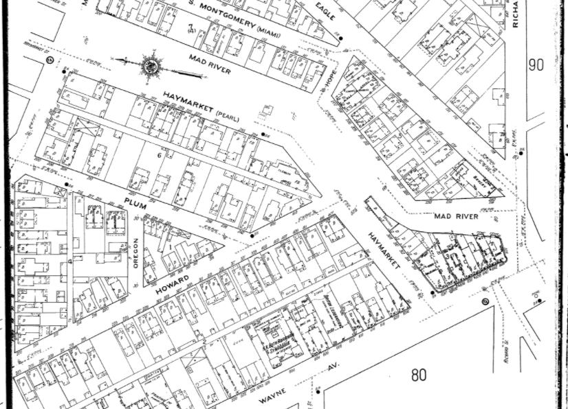
I have not come across any photographs that document the market (photos of the larger Haymarket neighborhood are themselves scarce), so our best bet is to study an old map of the area.
Here we can see Haymarket Street, which later came to be known as Pearl Street:
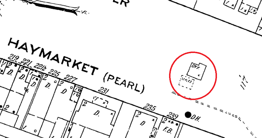
And if we zoom in, we can see the scales and weigher’s office are labeled.
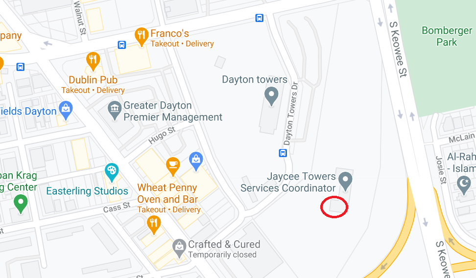
On this map, the red circle marks the approximate location of that site today:
The Decline and Demolition of the Haymarket
With the spread of the automobile, horse trading significantly decreased and the need for the “master of weights” slowly dissipated.
In its final years, the market was retained only as a convenience to certain farmers, and it was no longer staffed regularly.
Finally, in early November 1924, “the outside machinery consisting of large scales, platform measuring devices and similar mechanism for weighing heavy loads, was torn up and the gaping holes they left in the street were paved over.”
A few days later the scale house was demolished.
The surrounding neighborhood would hang around for a few more decades before it too met the wrecking ball in one of Dayton’s most fully realized examples of urban renewal.
Sources
“Haymarket, Scale House, Landmarks Are to be Razed,” Dayton Daily News, 11/14/1924
Sanborn Fire Insurance Maps


Greetings,
I am now reading your book: “Lost Dayton Ohio” and became interested in the location and European-like street layout of the former. Haymarket District. Question: Is the website: “Historic Aerials” (historicaerials.com/viewer) in your background? I have been a fan of this site for years, and used it to see what the Haymarket district looked like in 1956, which was the earliest aerial imagery available for this area. When you go to the site, you do NOT have to create an account or buy anything. Just type in Dayton, Ohio, or the zipcode and you’ll see a street map. Slide to “Bomberger Park”, then select from the drop down menu of aerial databases available by year (1956 on-up for this case). Warning: this site is addictive! For instance, you can see what the area now know as Huber Heights looked like before the I-70 and I-75 freeways were built and before the first plat of homes was built. You can then step-up through the years and see the interstates and rapid spread of homes which now cover the area. You can go anywhere else in the US you might be interested in.
I shall enjoy continuing to read your book! Sincerely, Curt Clark